WSi News2019-05-03 14:53:57
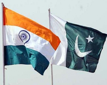
India Pakistan Borders: Cartography without Geographical Frontiers
By Manoj Kumar, Indian Border Force, Second in Command, STC Chakur
The first comprehensive frontier concept was explicitly expressed by Lord Curzon in his Romanes lectures at Oxford in 1907. The deciding factor in carving geographical boundaries in Indian subcontinent was the outcome of rivalry between Great Britain and Russia, the boundaries of North Western frontiers in South Asia is British creation. The boundary line between India and erstwhile Pakistan were based of concentration of ethnic population and not marked prominently by geographical features.
The western border of India though was divided on ethnic basis but in states like Punjab the division was actually of culturally similar population. Almost all the rivers are flowing from North East to South West i.e., from India to Pakistan. The Thar Desert is also extended into Pakistan territory and even in case of creeks in Gujrat the disputes on territories are not due to any prominent geographical feature. The case of western border of India is an interesting case study not only in terms of geographical similarity but also the security challenges that it has created for India, as far as border security is concerned.
The border of Punjab state where rivers like Ravi are flowing from India to Pakistan not once but several times the rivers is cris-crossing into the two countries, the gaps that are being created by rivers and their tributaries are being exploited by terrorists and smugglers. During the monsoon season the when the rivers are flooded smugglers use methods like snorkeling, hiding narcotics in hyacinths bunches, and even use of animal carcasses for hiding consignments through water channels. The homogeneity of terrain has helped Punjab to become part of ‘Golden Crescent’ of narcotics trade in South Asia. The shifting sand dunes of Rajasthan extends to both India and Pakistan and sometimes even the boundary pillars are lost under these sand dunes, even though India has constructed border fencing in the desert, but maintenance of this fencing is very difficult. Coming to state of Gujarat, the India and Pakistan border merge with creeks and the area is marshy, where even deployment of guarding forces is very difficult. Large part of border of Rann of Kutch remains inundated making navigation very difficult. All these instances are quoted in context to assert that the demarcation of the two countries has not made based on any geographical features and to date it is posing challenges for security but also inconveniences to local population.
For securing borders India must deploy its border guarding force in a comparatively large number supplemented by physical security infrastructure like border fencing. The over-securitization invariably causes inconveniences to local population but due to the security conditions India has been left with no choice but to continue with present system. Various studies have been conducted by Indian Universities like in Amritsar, about the social and economic impact and have produced interesting data such as loss of man hours due to security procedures to be followed by farmers whose land is ahead of security fence and loss in terms of capital value of land. On the Indian side, border villages due to night curfew notification, which is done concerned District Magistrates/Commissioners, severely impacts the freedom of movement during night time. Even the physical infrastructure is also less developed in comparison to hinterland due to neglect and strategic reasons, which at times means these areas are sometimes called degradingly as ‘border areas’ by locals.
To read the full story:http://world-border-congress.com/wp-content/uploads/2019/03/BSRMarApr2019.pdf
For more information contact: